![]()
Pajaro River Flood Risk Management Project
Partners
The Pajaro River Federal Flood Control Project was built in 1949 by the United States Army Corps of Engineers (Corps) and is maintained jointly by
- The Santa Cruz County Flood Control and Water Conservation District – Zone 7 (District)
- The Monterey County Water Resources Agency (MCWRA).
Project Overview
The Pajaro River Flood Risk Management Project (Project) is a multi-benefit project that will reduce flood risk to the City of Watsonville, the Town of Pajaro, and surrounding residential and agricultural land.
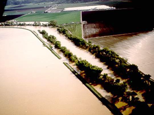
The existing and proposed levee project protects the economically disadvantaged City of Watsonville in Santa Cruz County and Town of Pajaro in Monterey County, where per capita income is less than half the state and national average. The Project also impacts some of the most productive farmland in the world; agriculture is a $750 million to $1 billion per year industry in the Pajaro Valley. The Watsonville-Salinas agricultural region produces twice as many strawberries as any other area in California, and California produces nearly 80% of the nation’s strawberries. Strawberries are California’s 4th highest-grossing agricultural commodity, producing $3.1 billion in annual revenue.
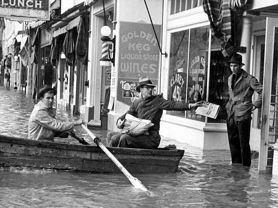
History of the Levees & Flooding
The Project plans to construct over 10 miles of setback levee and re-establish over 110 acres of historical floodplain creating significant habitat enhancement and groundwater recharge opportunities. The Project seeks to strike a balance between public health and safety, protecting the environment, and supporting the local economy.
1949 - 1970's
Since construction of the levee system in 1949, there have been several major floods on the Pajaro River and its tributaries, including overtopping events in 1955 and 1958. A 1963 report by the U.S. Army Corps of Engineers concluded that the levee system was “inadequate,” and Congress authorized reconstruction of the Pajaro River levee system in 1966 through Section 203 of the Flood Control Act of 1966 (Public Law 89-789, 80 Stat. 1421). The Army Corps and local community failed to come to an agreement on how to provide additional flood risk reduction in the late 1970s.
Flooding In The 1990's
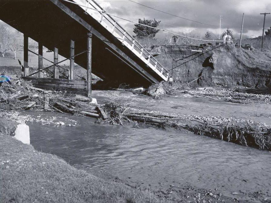
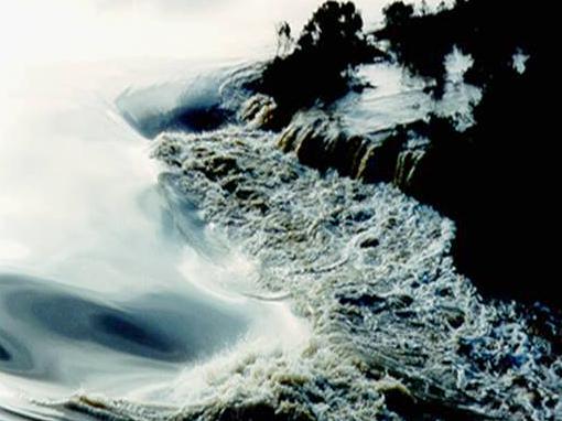
While the project languished in a protracted planning phase, additional major flooding occurred in 1995 and 1998 that resulted in significant inundation and damage caused by overtopping or breaching of the levees, including loss of life. Floods in 1995 caused more than $95 million in damage and two people lost their lives, with additional damage in 1997 and 1998 and displacement of hundreds of residents. Levels of flood protection along the Pajaro River system are among the lowest of any federal flood control project in California.
2016 - Present
Recent (2016) Corps analysis shows the levees provide only 5-year protection along the Pajaro River and 7-year protection along two Pajaro tributaries. Poor levee strength further reduces this expected performance. Levees nearly broke again in the federally declared storm disasters of January-February 2017, and a 1600-foot-long seepage berm was needed to buttress the outboard levee flank when numerous observations of seepage and boils were made.
Recent Milestones Forward
Despite the project’s long history, several key milestones have been reached in the past few years.
Feasibility Phase Completion - 2019
The Feasibility Phase for the Project was recently completed by the Corps with the December 12, 2019 release of a finalized General Re-evaluation Report and Environmental Assessment (GRR/EA). The GRR/EA is accompanied by a signed Director’s Report, which reiterates the Congressional authorization for levee reconstruction originally granted in 1966. The GRR/EA describes formulation of alternative plans to reduce flood risk in the Project area, evaluates economic and environmental impacts of the alternatives, including the no action alternative, and identifies the plan that maximizes the net National Economic Development (NED) benefits and complies with applicable federal and state environmental regulations.
Final EIR Expected 2021
A Draft Environmental Impact Statement/Environmental Impact Report (EIS/EIR) was prepared by Cardno Entrix in April 2011 to support the Project. However, due to the changes that precipitated from the USACE implementation of the SMART Planning process, the NEPA and CEQA processes were separated. The GRR/EA includes a Finding of No Significant Impact (FONSI) in compliance with the National Environmental Policy Act (NEPA). The local non-federal sponsors will complete the California Environmental Quality Act (CEQA) environmental review process, culminating in a Final Certified EIR in 2021. As such, both Federal and State environmental review will be completed prior to production of 30% designs developed by the Corps during initial phases of Preconstruction Engineering and Design (PED). The recent awards of $1.8 million and $2.815 million in the Army Corps Work Plans of federal fiscal years 2020 and 2021 will provide the necessary funding to begin the project’s design phase in 2021. All necessary permits from Federal, State, and local agencies will be secured during the PED phase.
Project Documents & Resources
Staff Contact Information
Santa Cruz County Flood Control and Water Conservation District – Zone 7
Dr. Mark Strudley
Flood Control Program Manager
Monterey County Water Resources Agency
Mark Foxworthy, P.E.
Associate Engineer